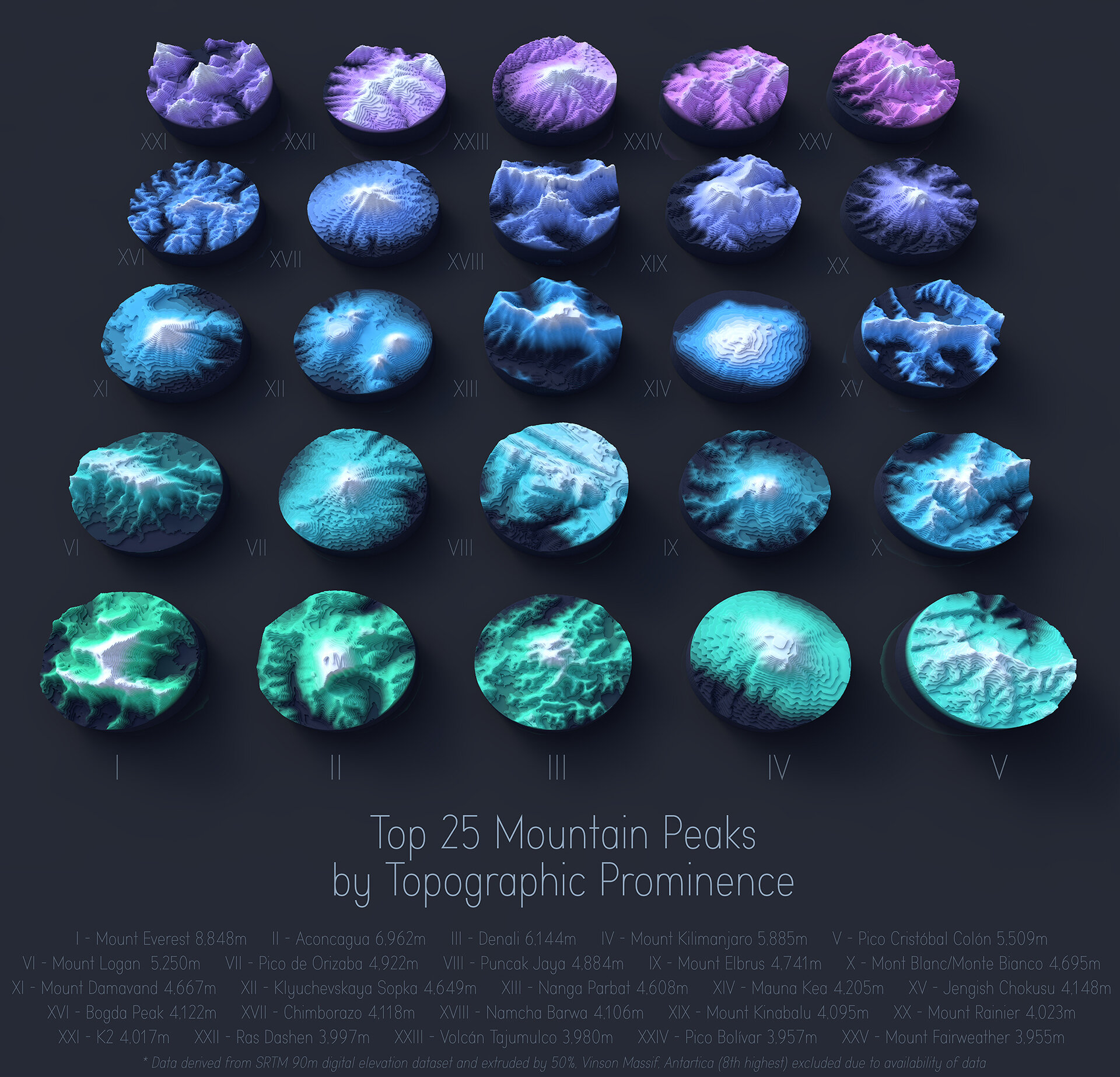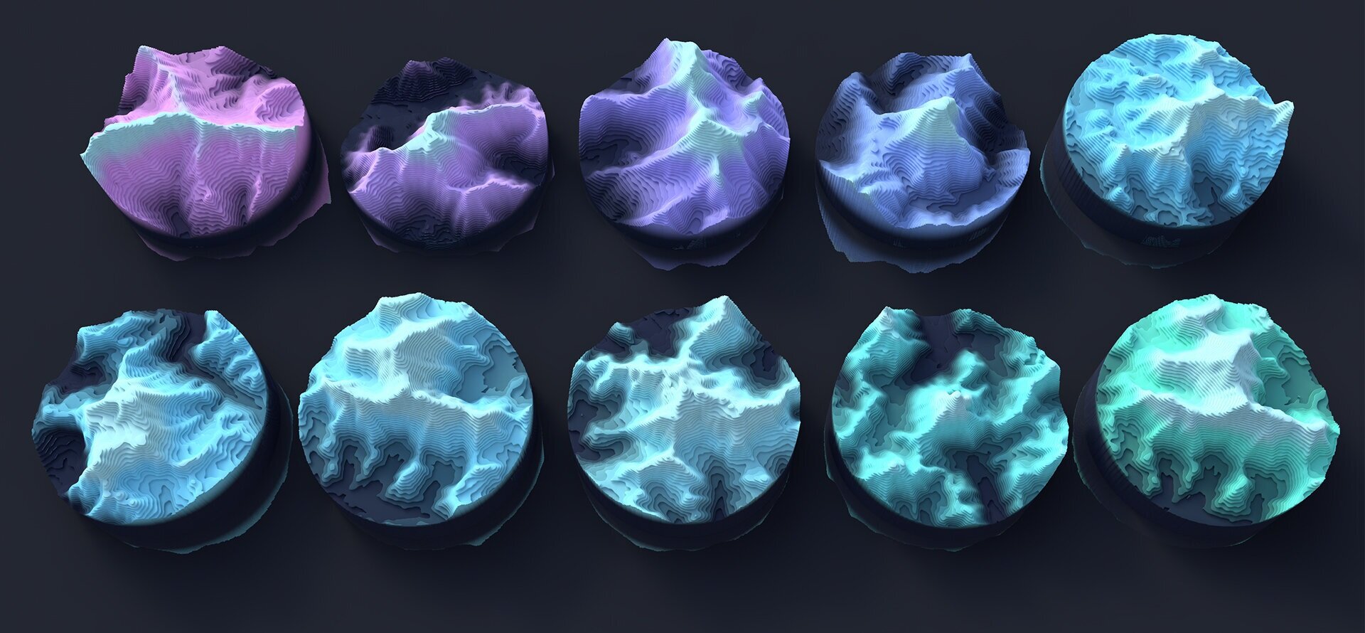
Mini Mountains
The below images are a selection from my latest project visualising mountain peaks as miniature models sliced up by their contours. The data is derived from SRTM 90m digital terrain datasets using DEM Earth (https://cinemaplugins.com/c4d-plugins/dem-earth/), Each peak has a unique colour gradient to differentiate them from each other and the fall off in gradient signifies the height.
I decided to visualise the peaks by the absolute peak height and secondly by the topographic prominence. Absolute height is an obvious metric to use however many of the tallest peaks exist on the same parent mountain and meant visualising is a little tricky. Topographic prominence allowed for a little more variation and is a metric depicting the minimum height of the climb to the summit from a higher peak or sea level.
It should be noted that I unfortunately had to exclude Vinson Massif (Antartica) from the visualisation which is the 8th highest peak by prominence. The lack of topographic data for Antartica made this hard to visualise.
Peak height data source: http://www.peaklist.org
Each model was created in Cinema4d by converting the DEM Earth model to a mesh and splitting the model into 50 each planes. Extracting the splines (contours), lofting, extruding and bevelling the caps gave the effect you can see below.
Ideally the next stage of this project is to have these mini models printed in 3d but thats a little ahead of me at the moment… Watch this space.